Performing takeoffs involves gathering a lot of information quickly, automated processes, and repetitive math, so it is no wonder that digital takeoffs have been part of the DNA of construction companies for a long time.
“I’m not sure what traditional takeoff means anymore since most contractors are using some automated means of calculating amounts for takeoffs,” says Alan Sharp, business area director–CEC Software Solutions at Trimble Navigation Ltd.
When Trimble acquired Spectra Precision in 2000, that company had software called PayDirt, which was a PC-based takeoff program. It did a lot of the calculations for building site models for machine control. At that time, Trimble already had a model called TerraModel, which was a full-blown CAD civil suite.
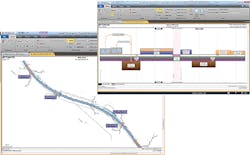
“One of the first things Trimble kicked off after acquiring Spectra Precision was the Trimble Business Center platform,” says Sharp. “Its goal was to bring together the takeoff models such as PayDirt and TerraModel; it provides the model-building capabilities of TerraModel, plus the surveying capabilities of our geospatial product, called Trimble GeoMax Office. So, we built a product from the ground up.”
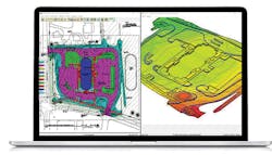
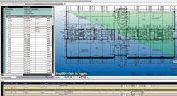
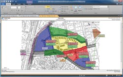
Trimble offers two-dimensional and three-dimensional takeoff. 2D sums up the totals, such as point data, line data, or area-based data which goes into an Excel-like spreadsheet and gives you all of the areas, lengths, and counts. It gets used for things such as white striping on a road, the number of street lights to be installed, or the number of trees to be planted. It aids in counting, but not in identifying, objects in relation to other objects.
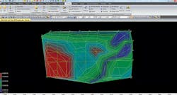
For 3D takeoffs, you can start from paper plans and digitize them. Piece together all the 3D information based on what is in the plans and then build up a set of 3D line work that represents the contours of the features and from those, you make surface models.
Trimble’s takeoff reports give you a master Excel report that you can take into the estimating process. “We do a certain degree of the cost in our software, such as the cost of materials, installation costs, but we don’t do a full estimate. Contractors will take our reports and put them into their estimation software and apply things like labor, production rates, and equipment costs,” says Sharp.
Topcon has been in the digital takeoff market for a long time, too. They acquired Civilcad, an Australian CAD/design program in 1991, primarily for the survey and construction markets. “We used this program as the base product to build upon and migrated it into what is known today as Topcon’s MAGNET Office solutions,” says Barkley Hensley, product manager at Topcon Positioning Systems. “Customers were asking for a takeoff package. They wanted more than just surface volumes between digital terrain models. Material volumes, counts, lengths, and areas were also required. So, we developed a collection of takeoff specific tools and combined them with our mass haul, 3D visualization, and scheduling products to create MAGNET Project.”
Hensley continues, “In the old days, you knew how much dirt you had to move, whether it was cut or fill, and you had two surfaces that reflected existing configuration and design configuration. That is what you had—just two surface volumes. You could split them in different ways, but you were always running down volumes between surfaces.”
MAGNET Project does run volumes between surfaces, but it will also give you earthworks volumes, your cuts, and fills; with it, you can assign materials to specific areas so you can get the volume and cost of any material and those values listed in specialized reports. Material takeoffs can be generated from either 2D or 3D data.
“Oftentimes, the transition from manual to digital takeoffs is met with resistance,” says Marco Cecala, president, Take-Off Professionals (TOPS). The company has been helping contractors with their digital data and takeoffs for 28 years. “Clients may be wary of technology and they may feel more comfortable with a traditional approach. The other concern is a computer savvy estimator may not be sure what software will work for them. I recommend visiting trade shows and have vendors show you their offerings. There will be software that appeals to you and the way you work. Be sure to verify they have the training you can benefit from. We all learn differently. Some people learn by watching—others by being coached through processes.”
Software breaks down into basic types: CAD-based and non-CAD based. “We are applications people,” says Cecala. “Between all the people in our company, we use every software available, so we are well-versed in them. We have come to some people who came from an AutoCAD background and they work with CAD-base, such as Civil 3D or Carlson. Either way, you got to learn mouse clicks. The non-CAD-based software is geared towards doing what contractors do every day, such as takeoffs. It takes a simpler approach, is pretty procedural and a little bit intuitive, so it helps a new user to get comfortable.”
When it comes to choosing between CAD-based and non-CAD-based software, Cecala says it reminds him of the Ford/Chevy debate. “They both work. This software can do this, but that software can do something different. Computer people always want everything, so use the one that gives you the most of what you need and enjoy using it.”
Although digital takeoffs have been around for a long time, the technology is evolving to meet the needs of the modern contractor.
The Latest in Digital Takeoff
At the beginning of this year, Topcon Positioning Group announced the newest edition of its suite of software solutions: MAGNET 5.1. New updates include support for the new HiPer VR GNSS receiver, a piping and trenching module with new capabilities specifically for the oil and gas segment, as well as the ability to orient and scale a PDF directly on a field controller and set it as a background image. As well, the service plans and subscriptions for MAGNET Office now include MAGNET Enterprise, license check-in and check-out, direct email support, and an eLearning fundamentals course.
InSite Software Inc. recently added a new rendering engine, which makes vector PDF takeoff even faster, and drone import, which allows fast-grade TOPO verifications and as-built calculations to their digital takeoff solution: SiteWork. “At InSite Software Inc., we focus on three things; speed, accuracy, and validation. Recent upgrades provide faster performance. Accuracy is assured with triangulated surface (TIN) calculations that can be imported into a GPS machine control device when bids are won. Validation is assured with 3D Live, which instantly converts 2D data from PDF files into 3D images that can be used to prove calculations,” says Steve Warfle, InSite Software Inc., product manager.
Many new features are designed primarily to improve the speed and accuracy of data gathering, as well as the user experience, which is not unlike the software’s most popular features.
What Everybody Wants
Hensley says one of the most popular features on Topcon’s solution is the ability to take 2D CAD documents and 2D PDFs and turn them into 3D projects where you can elevate quickly and easily through the software’s intuitive user design. Then, you can transfer all of your material volumes to the company’s Mass Haul and Scheduling UI for optimized material placement and scheduling.
“Not only do you have a takeoff package, but there are several products included for other tasks. Whether you are doing a survey or a subdivision design or whatever you are doing, you have all the tools within MAGNET Project; it’s not just a mini set of takeoff features. It has the whole civil design CAD package combined, so you have a lot of different functionalities included when you need it,” says Hensley.
“Lump sum bidding has big risks which are minimized by having proper quantities at bid creation,” says Warfle. “InSite SiteWork’s comprehensive features provide solutions to minimize risk from site takeoff to layout and machine control. These features make the estimator’s job much easier, which means more jobs can be bid in a short amount of time.”
“After we build the takeoff model and the contractor is building the job in the field, we will often process quantities from a TOPO of their site—either from a four-wheeler, a drone, or even just walking around taking spot elevations—and send us that information. We will then give them an interim takeoff so they can better monitor their progress,” says Cecala.
“We have a product that goes end to end—field to finish, whether you are doing a takeoff, 3D modeling, construction operations, or you’re doing field survey work. One product can do it all but its modular, so you can buy just the tools that suit you,” says Sharp.
Having a technology that can be used by all staff at each stage of the construction process is an attractive feature. Sometimes in a construction company, estimators use one software and operations use another, and the two products don’t speak the same language. This leads to a lack of correlation between estimation and operation. “More and more, people are moving towards using an integrated platform that does it all rather than using different products for different parts of the workflow, because that creates bottlenecks and gaps that you have to overcome,” says Sharp.
Lastly, a lot of contractors are building 3D models. “If you go to a job site with a 3D model in your hands, you basically have the job site on a stick in your hands,” says Cecala.
Most people associate advanced technology with big jobs, but according to Cecala, 3D modeling is great for smaller jobs too. “If you are working a small job and you can’t do the retention one day, you can do the building pad, and if the necessary people aren’t there to certify the building pad, you can lay out the curb. You have the flexibility to move from one scope to another without having to have a surveyor come out and stake something or have to measure and get information about the next step,” he says.
“Our software allows users to convert CAD or PDF cross sections into 3D models very quickly within a few minutes and then use that to calculate totals,” says Sharp. “Contractors appreciate that they can get initial earthworks quantities out quickly, whereas other solutions need to digitize those cross-sections first before calculating quantities, which takes longer. This is especially popular with contractors performing road-, rail-, or any corridor-based projects.”
“We can send 3D models and supporting information to Topcon’s 3DMC systems. From MAGNET Project, machines can be connected to directly or through Topcon’s web services such as MAGNET Enterprise,” says Hensley. “You can stay in one solution from start to finish.”
Construction is a diverse industry with different technology needs; construction technology companies must be prepared to offer the proper tools to these niche markets. Software solutions also provide numerous features that are lesser known but can still provide great value.
Digital Takeoffs Best-Kept Secrets
Hensley says Topcon’s clash detection isn’t as well-known as some of its other features. “MAGNET Modeler, which is included in MAGNET, allows you to not only assign materials for takeoff but also to assign textures and 3D objects and 3D areas. At the push of a button, you can get an actual 3D visualization and inspect the model and look at whatever you need.”
Hensley continues, “It has the ability to do clash detection. It’s a value-based clash detection. You can prioritize clashes by the level of importance, and you can very quickly see if you have a clash, such as a pipe going through a concrete slab, that you didn’t see in your CAD design.” This can be a huge cost- and time-saving advantage.
InSite says its software solution’s ability to allow for the merging of data from multiple PDF, CAD, Data Collector, and Drone import files and to keep track of the alignments is one of the company’s lesser-known features, yet it allows the largest jobs to be completed. “The offsets and slope to daylight functions take unfinished designs and turn them into completed designs,” says Warfle. “Contractors can add value engineering to their capabilities with the Dynamic Site Balancer, which quickly allows TOPO changes to minimize fill import or export. The cross-section and plan view graphics provide proof that the takeoff is correct, and the comprehensive reports can be exported to most bidding applications and spreadsheets. We also provide online training each month that makes contractors power users in a short time.”
Trimble is exploring the use of its software in underground utilities applications. Contractors are using it to build the underground utility model, plus the trench model, plus all of the backfill quantities. “Within a few minutes, we can generate a lot of quantity information quickly that is not so easy to achieve by another means,” says Sharp.
However, Sharp counters, “It is difficult to know which features are lesser known. Different applications require different features to different degrees.” Therefore, less utilized features might not be less known, just useful only to a smaller customer base.
Digital takeoffs not only provide more accurate takeoffs that get completed more quickly, but they also have a number of other benefits.
Improving the Entire Construction Process
According to Cecala, the information gathered when performing a takeoff provides the chance to do a snapshot that will be beneficial to the overall project. “Depending on your scope of work, there are a lot of things this information is going to do. For instance, you have a stockpile of dirt and you know you need a certain amount of yardage for topsoil or to go to a fill area, and you are going to excavate a retention area, so now you have two sources of dirt; so you measure the stockpile, so you have its numbers, and then you do a quick surface takeoff of the retention area. Let’s say that it is half-dug, and you do a TOPO, then go to the software and determine the cut-fill quantity for this area, and then you know how much yardage remains in the retention. You add that to the stockpile amount and now you have an instant calculation of how much dirt is available, so now you know if you will need it for the fill areas or if you can start exporting dirt to clean up your job site,” says Cecala.
“Digital takeoffs allow contractors to bid the projects with less risk and be more efficient once they get on site,” says Sharp.
As well, 3D models are not only helpful to the contractor to identify project needs, costs, and timelines, they are also useful in communicating that information to the client. “When using 3D models, the customer truly understands the construction plans by the time the models are built. And they understand the construction product much better having built the models. Otherwise, it can be difficult to visualize the end product and all of the steps needed to get there,” says Sharp. “When they don’t make models, there are elements that are unknown that are not being found during the bid process. Then they find them during operations but, by then, there are costs or claims associated with it that can be time consuming and expensive, plus troublesome for client relationships, so if you build the model up front, you can find those issues earlier.”
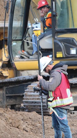
However, perhaps one of the biggest benefits to a digital takeoff is that the data collected at that point can be used for machine control.
“Estimators typically work with less accurate numbers due to the speed at which they have to do their work. With Trimble, you can create a quick-and-dirty model for estimating and then a more precise model for machine control. You don’t have to recreate everything from scratch; you can just improve the quality of information by incorporating digital CAD data or entering data accurately off the plans rather than using the digitized data used at the estimating stage. Trimble Business Center is not a pure estimating product, it’s not a pure operations model, it’s a combination of both.”
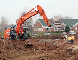
For example, with Trimble’s new updates for trenching, data can be uploaded to an excavator and via automated trenching and customers can enjoy the additional benefit of machine control. “I know of many contractors who have acquired machine control in order to take advantage of the downstream benefits of estimating with a 3D modeling tool,” says Sharp.
“Since machine control became a reality, we started building data and then morphed into aerial photogrammetry with drones and full-scale aircraft, as well as sonar and lidar so, you could say, we are into the manipulation of all things three dimensional,” says Cecala. “If the contractor uses machines equipped with GPS grade control, we will build that 3D model for their machine control.”
Cecala continues, “There is a definite break between a takeoff model and a machine control model. We can sometimes use this data in our machine control plans but, more often, we start from scratch. Many times, plans have changed since takeoff or value engineering is involved so it is not exactly how it was at takeoff.”
“What I find, the more you talk to contractors, machine control has revolutionized construction. In addition, contractors are now seeing the importance of being able to digitally monitor, document, and compare as-built models to design models. What they are doing is basically building a horizontal BIM model of the project. This allows a contractor to build a digital trail of activity during construction. Using cloud-based services to schedule tasks and monitor progress is all now possible. Paper plans will continue to be part of a construction project, however more and more surveyors, engineers, and contractors are seeing the benefit of a completely digital site.”
